Pembina County, ND - Cities
Cities
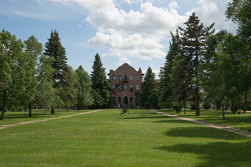
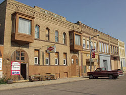
Bathgate, North Dakota is located in northeastern Pembina County on the bank of the Tongue River, along Pembina County Highway 1. It is about 11 miles west of Interstate 29 off Exit 206 and 15 miles south of the Canadian Border. The city was founded in 1879 as Bayview. However, it was renamed in 1881 as Bathgate after the community of Bathgate, Scotland. In 1908, the North Dakota School for the Blind was built in Bathgate. The School for the Blind operated until the 1960s. Today, the building remains and is occupied by a local publishing business.
According to 2000 US Census, 66 people lived in Bathgate. The median household income in 2000 was $36,250. In 2008, the estimated median house value in Bathgate was $37,529.
Much of the movie Fargo (1996) was filmed in Bathgate and the surrounding area. In addition, Bathgate was home the childhood home of former world-champion figure skater and speed skater, Norval Baptie.
The agricultural-based community is full of character and history. When traveling through, know that Bathgate has limited services available.
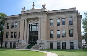
Cavalier, North Dakota is located on the Tongue River, at the intersection of North Dakota Highways 5 and 18. The city is just 19 miles from Interstate 29 off Exit 203. Cavalier was established in 1877 and in 1911 became the county seat of Pembina County.
The City was named after Charles Turner Cavileer, who was born in Ohio and later operated businesses in the St. Paul, Minnesota area. He arrived in Pembina in 1851 as the first Customs Collector at the International Port of Entry. He was also a fur trader. He served as the city of Pembina’s first postmaster, from 1864-1884. Cavileer was documented as the first permanent white settler in the state of North Dakota.
The Cavalier Air Force Station is located about 14 miles Southwest of Cavalier. The Cavalier Air Force Station was built in the early 1970s. It provides critical missile warning and space surveillance data to various government agencies. Approximately 30 military and several civil service people are stationed on the base.
Icelandic State Park, along with the Gunlogson Arboretum Nature Preserve and the Pembina County Historical Society Museum are located 5 miles West of Cavalier on North Dakota Highway 5. The Cavalier Public School gained recognition in the early 2000’s when its class AA football team had a 47-game winning streak (from 2002-2005), the second longest in ND high school football history.
The U.S. Census Bureau Population Estimate for Cavalier in 2008 was 1,322. The 2008 estimated median household income in Cavalier was $51,141. The estimated median house value in the community in 2008 was $114,087. Many residents of Cavalier work in agriculture and related businesses.
Cavalier’s many amenities include a hotel, bed and breakfast, hospital, several restaurants and bars, gas stations (with 24/7 self service), ATMs, convenience stores, grocery store and various retail shopping.
Visit Cavalier’s website to learn more about this growing community at http://www.cavaliernd.com/.
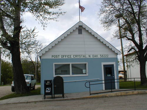
Crystal, North Dakota is located in southwestern Pembina County on North Dakota Highway 66. The community is only a 24 mile drive from Interest State 29’s Exit 187. Crystal was founded in 1879.
According to the 2000 U.S. Census, Crystal’s population was 167. At this time, the community’s median household income was $28,571. The median value of houses in Crystal was $32,500. In 1997, the Crystal Bridge on Appleton Avenue over Cart Creek was listed on the National Historic Register. Crystal offers a large, scenic city park with ball diamonds and picnic areas.
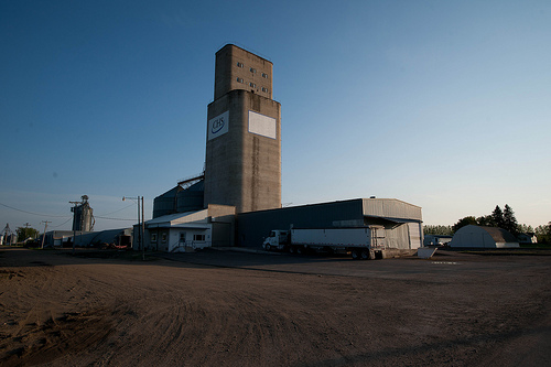
Surrounded by rich soil, Crystal sits in the middle of the Northern Red River Valley’s agricultural region. In 2010, Simplot Grower Solutions and Columbia Grain International started construction on two new large facilities in Crystal. They are working together to add a loop railroad track for 110-car unit trains. Simplot is adding a 25,000-ton fertilizer plant and Columbia Grain is adding a new grain terminal.
Crystal offers several amenities to visitors, including a gas station (with 24/7 self service) with convenience store, café and ATM. There are also bars that serve food.
Drayton, North Dakota was founded in 1878 by a group of people who had migrated from Drayton, Ontario Canada. The current city of Drayton was named after the settler’s Canadian hometown. Drayton is located along Interstate 29, about 30 miles south of the Canadian border and 45 miles north of Grand Forks, ND. It also sits on North Dakota Highway 66, which connects to Minnesota Highway 11.
In its early years, Drayton became an important river boat landing on the Red River, because it is located on the highest point between Grand Forks, North Dakota and Winnipeg, Manitoba. Today, Drayton is known for cat fishing and the annual Drayton River Fest on the banks of the Red River. The Ox Cart Trail Society celebrates the community’s rich history. The city has been named the real life setting of Blessings, North Dakota, a fictional city created by author Lauraine Snelling’s series of books about life in a North Dakota frontier community.
According to the 2000 U.S. Census, there were 913 people living in Drayton at that time. The median household income was $37,344. The median value of a house in Drayton at that time was $51,500. The largest employer in Drayton is the American Crystal Sugar processing facility, which processes sugar beets from agricultural producers in the Northern Red River Valley.
Drayton has many amenities available for its visitors including, gas stations, a convenience store, ATM, a restaurant, bars that serve food, hotels a grocery store and a clinic. Drayton is the city nearest to the Canadian border (on the United States side) along Interstate 29 offering a hotel.
For more information about the city of Drayton, please visit their website at http://www.draytonnd.com/.
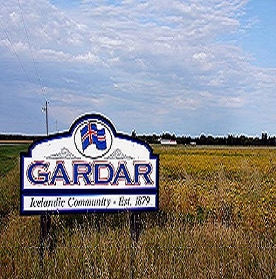
Gardar, North Dakota is located in Southwestern Pembina County, a mile west of North Dakota Highway 32. It is located about 33 miles South of the Canadian border. Originally called Park, Gardar was an Icelandic settlement established in about 1879.
According to the 2000 Census, the community had 89 residents. The median household income at that time was $40,833. Gardar is home to two historic churches and an antique store.
Gardar lies in a beautiful location, near where the Red River Valley and the escarpment meet. When traveling through, know that Gardar has limited services available.
Glasston, North Dakota is a small farming community located in Eastern Pembina County. It is located along U.S. Highway 81, midway between Hamilton and St. Thomas. It is about 17 miles from Interstate 29. The city was established in 1886 as a station along the Great Northern Railroad. It was originally known as Baltimore, but was later renamed after the community’s post master (Archibald Glass). Glasston is an unincorporated city and its population has rarely exceeded 100 people in its history.
When traveling through Glasston, know that it has limited services available.
Hamilton, North Dakota is located in Eastern Pembina County. The city is located along North Dakota Highway 5, about 10 miles west of Interstate 29. It was founded in 1882. Many residents of the community have Norwegian and German ancestry.
According to the 2000 U.S. Census, 73 people lived in Hamilton. The median household income at that time was $35,625. The average value of a house in Hamilton was $28,800.
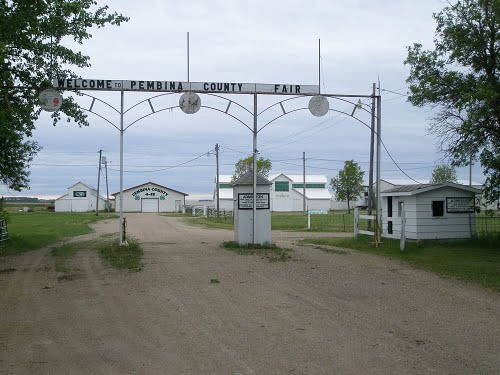
Hamilton is surrounded by the rich soil of the Red River Valley. Because of this, the community has always been agriculturally-based. Hamilton is best known for housing the Pembina County Fair, “The Biggest Little Fair in North Dakota.”
When traveling through, know that Hamilton has limited services available. It does offer a bank and a bar that serves food.
Hensel North Dakota is an agricultural community located in central Pembina County, about 23 miles west of Interstate 29. The rural community is located along Pembina County Road 3, about 9 miles east of Mountain, ND.
Hensel was officially incorporated as Canton City in 1882. Through its existence, it has been known as Canton, Canton City, Canton Village and Hensel. It was renamed Hensel by the name of the post master’s (Joseph Irwin) Canadian hometown. Many of the community’s residents are of Icelandic, Norwegian or German descent.
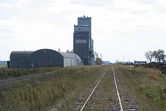
The 2000 U.S. Census Bureau indicated that 42 people lived in Hensel at that time. The median household income at that time was $31,250. The average value of a home in the community was $17,500. Today the community is home to a grain elevator and several small businesses.
When traveling through Hensel, know that it has limited services available.

Mountain, North Dakota is located in western Pembina County, about 42 miles west of Interstate 29. The city sits on a hill along North Dakota Highway 32. The city of Mountain was founded in 1884.
Mountain is home to North America’s oldest Icelandic Lutheran church, Vikur Lutheran Church, which was built in 1884. The community is best known for its Icelandic culture and its annual August the 2nd festival, which celebrates Iceland’s journey to independence from Denmark. It has been celebrated for over 100 years. Each year, thousands of people from around the world flock to Mountain to celebrate. It is the oldest ethnic festival in the state of North Dakota and the largest Icelandic ethnic event in the United States.
According to the 2000 U.S. Census, there were 133 people in the community at that time. At that time, the median household income was $23,750. The median value of a home was $23,800. The city is currently constructing a $1.6 million community center which is open as of April 30, 2011. The community center offers a new café and a banquet room with a commercial catering kitchen that is available for rent by reservations.
Mountain offers several amenities to visitors including a café, a bar and (24/7) self service gas station. A bed and breakfast is located in rural Mountain.
Neche is located in North Central Pembina County, just 1 mile south of the Canadian border. The city is located along North Dakota Highway 18, along the Pembina River. The nearest community is Gretna, Manitoba on the other side of the United States-Canadian border.
Neche was founded in 1882. Its name was derived from the Native American word Ojibway, which means “friend”.
According to the 2000 U.S. Census, Neche’s population at that time was 437. The median household income at that time was $42,500. The average value of a house in Neche was $40,800. Well-known Neche residents include Henry Gurke, who was posthumously awarded the Medal of Honor by Franklin D. Roosevelt in World War II, and James Symington, former leader of the Exclusive Brethren.
Neche has some amenities available, including a gas station (self service 24/7) and a café. A Customs and Border Protection crossing at the United States-Canadian border is located just North of Neche on ND Highway 18.

Pembina, North Dakota is located in Northeastern Pembina County along Interstate 29, on the Minnesota border about 3 miles south of the Canadian border. It lies where the Red River and the Pembina River meet.
Pembina was named for the Chippewa word for high bush cranberries, which grew in the area. Pembina was the first settlement in the Dakota Territories. It was known to be inhabited as early as 1780. The first trading post was established in 1797. North Dakota’s first post office was established in Pembina in 1851. The city served as the county seat of Pembina County from 1867 to 1911, when Cavalier became the county seat.
According to the U.S. Census in 2000, there were 642 people in Pembina at that time. The median household income was $55,536. The median value of a house in Pembina was $65,000.
Pembina is home to the Pembina State Museum. The museum has an observation tower that on a clear day, allows visitors to see for 10 miles in all directions. Major employers in Pembina include U.S. Customs and a satellite plant of Motor Coach International, which builds busses.
Pembina has a number of amenities available to visitors, including gas stations (24/7 self service) with convenience stores and a deli, retail shopping and a grocery store. Pembina is located near one of three 24-hour ports of entry in North Dakota.
Visit the City of Pembina’s website to learn more about this historic community at http://pembina.govoffice.com/.
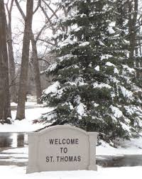
St. Thomas is located in Southeastern Pembina County, about 15 miles from Interstate 29. The city sits on U.S. Highway 81. Named after Saint Thomas, Ontario, Canada, this city was founded in 1881.
According to the 2000 U.S. Census, there were 447 people in the city at that time. The median household income was $31,094. The median value of a house in this city was $42,700. Founder and editor of Life Magazine, Edward K. Thompson, is a notable native of this community.
St. Thomas offers several amenities to its visitors, including a gas station with convenience store.
For more information about the city of St. Thomas, please visit their website at http://www.stthomasnd.govoffice3.com/
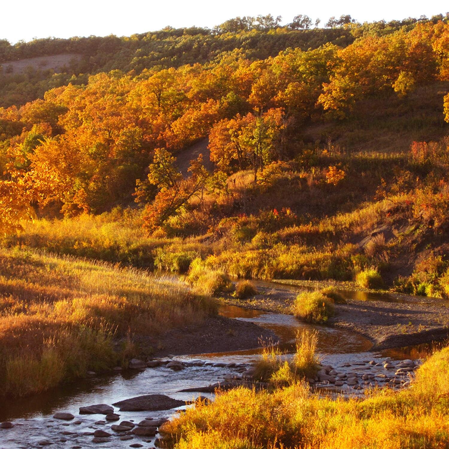
Walhalla, North Dakota sits on the Pembina River in the center of the Pembina Hills, in northwestern Pembina County. The city is 5 miles south of the Canadian border and 30 miles west of Minnesota; is served by ND State Highway 32, County Highway 55 and by Burlington Northern Railroad.
Walhalla was established in 1845. Many of its early residents included French and English fur traders, Catholic missionaries and settlers. The city was originally named St. Josephs, but in 1871 was changed to Walhalla, which means “Valley of the Gods”. As French and Native American populations combined when this community was formed, the Métis ethnic group emerged. The present day historic site, the Gingras Trading Post, honors the Métis heritage and is listed on the National Register of Historic Places.
According to the 2000 U.S. Census, there were 1,057 people living in the city at that time. The median household income was $31,875. The median value of a house in Walhalla was $49,300 at that time.
Walhalla is located in the beautiful Pembina Hills. The community and surrounding area have many attractions for visitors including a ski lodge and a summer Theater, wild life preserves, historical sites, parks and much more. Walhalla offers many amenities to those visiting the community including gas stations (24/7 self service), convenience stores, ATM, restaurants and a grocery store.
To learn more about this scenic community located in the Pembina Hills, visit their website at http://walhalland.org/.